DNR Unveils Wisconsin PFAS Contamination Map
New site shows a number of contaminated Milwaukee sites.
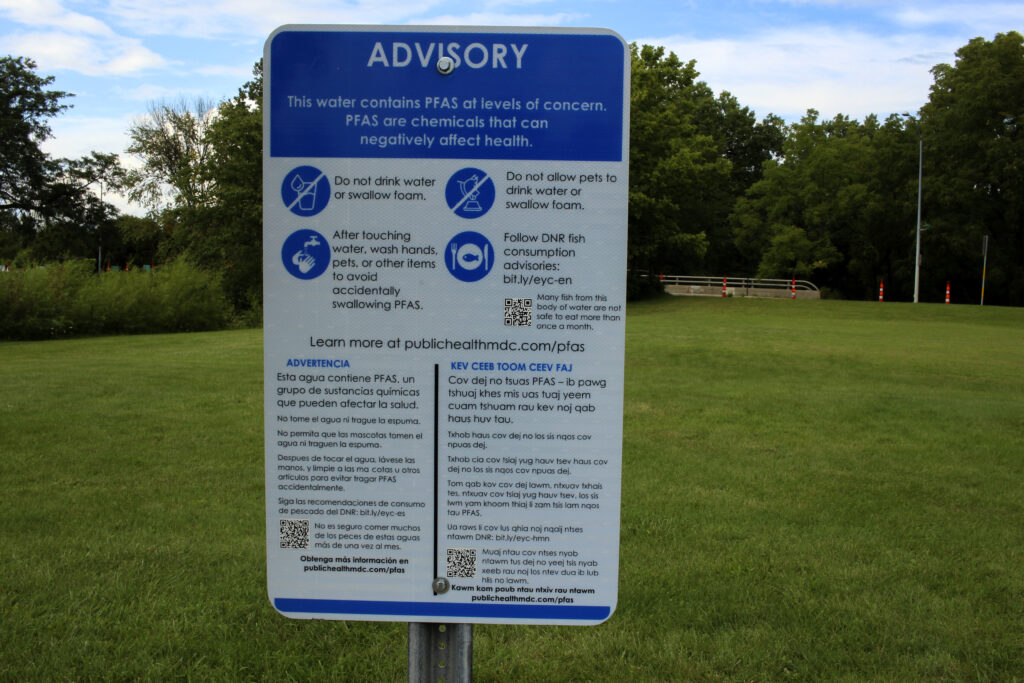
A PFAS advisory sign along Starkweather Creek. (Henry Redman | Wisconsin Examiner)
The Wisconsin Department of Natural Resources (DNR) released an interactive map on Tuesday detailing PFAS contamination in water sources and wildlife across the state.
The map, which tracks PFAS testing, levels in drinking water and fish consumption warnings, is the agency’s way to combine previously disparate data sources and inform residents about what’s going on with the water in their area.
Johnson added that communities across the state are going to get access to funding through the federal infrastructure law passed last year to mitigate PFAS pollution and that this data being in one location will help them plan.
“Making PFAS data available to the public is not new, PFAS data are plentiful,” she said. “But until this tool launched today, it required going to each data system separately to look for that information. The interactive data viewer compiles publicly available datasets about PFAS across Wisconsin in the water and land, fish and wildlife.”
PFAS are a family of man-made chemical compounds known as “forever chemicals” because they don’t break down easily in the body or environment. The chemicals, which can have harmful health effects, have been used in non-stick pans, fast food wrappers and certain kinds of firefighting foam.
The map shows locations in Wisconsin where there is an active PFAS cleanup site, where PFAS monitoring is taking place and where fish-consumption advisories have been issued.
The one-stop tool, which combines information from three separate DNR databases, was a recommendation of the Wisconsin PFAS Action Council, which was created by Gov. Tony Evers in 2019 to study the problem and coordinate efforts to reduce contamination.
“The more information we can gather about how PFAS are affecting communities and individuals across the state, the better we can work together to get resources out to folks in these impacted areas,” Evers said. “With the unprecedented funding flowing into our state from the federal Bipartisan Infrastructure Law and with the investments we’ve been able to make at the state level, there are more resources than ever to help communities address these issues, including this new mapping tool, which contains incredibly valuable information to help advance our fight to address PFAS contamination in Wisconsin.”
DNR unveils interactive map tracking PFAS across Wisconsin was originally published by Wisconsin Examiner.
More about the PFAS Problem
- EPA Slaps Two PFAS Chemicals With Superfund Law Designation - Danielle Kaeding - Apr 19th, 2024
- DNR Responds To EPA’s Designation Of PFOA And PFOS As Hazardous Substances - Wisconsin Department of Natural Resources - Apr 19th, 2024
- Evers Won’t Rule Out Court Challenge to Force Release of PFAS Funds - Danielle Kaeding - Apr 16th, 2024
- Gov. Evers Vetoes PFAS Bill, Calls Special Meeting of Budget Committee - Baylor Spears - Apr 10th, 2024
- DNR, DHS Respond To EPA’s Announcement Of Maximum Contaminant Levels For PFAS In Drinking Water - Wisconsin Department of Natural Resources - Apr 10th, 2024
- GOP Leaders Urge Gov. Evers to Sign Divisive PFAS Bill - Baylor Spears - Apr 2nd, 2024
- UW-Madison to Open PFAS Center - Robert D'Andrea - Apr 1st, 2024
- Gov. Evers Slams Republicans for Continued Delays Releasing Critical Funds to Fight PFAS Statewide, Stabilize Healthcare Industry in Western Wisconsin - Gov. Tony Evers - Mar 11th, 2024
- Wisconsin DNR Update On WMC And Leather Rich, Inc V. DNR - Wisconsin Department of Natural Resources - Mar 8th, 2024
- State Appeals Court Blocks DNR’s Regulation of PFAS - Danielle Kaeding - Mar 6th, 2024
Read more about PFAS Problem here